Frost-Apocalypse Set To Sweep Across US, Could Mark End Of Growing Season
Tyler Durdan
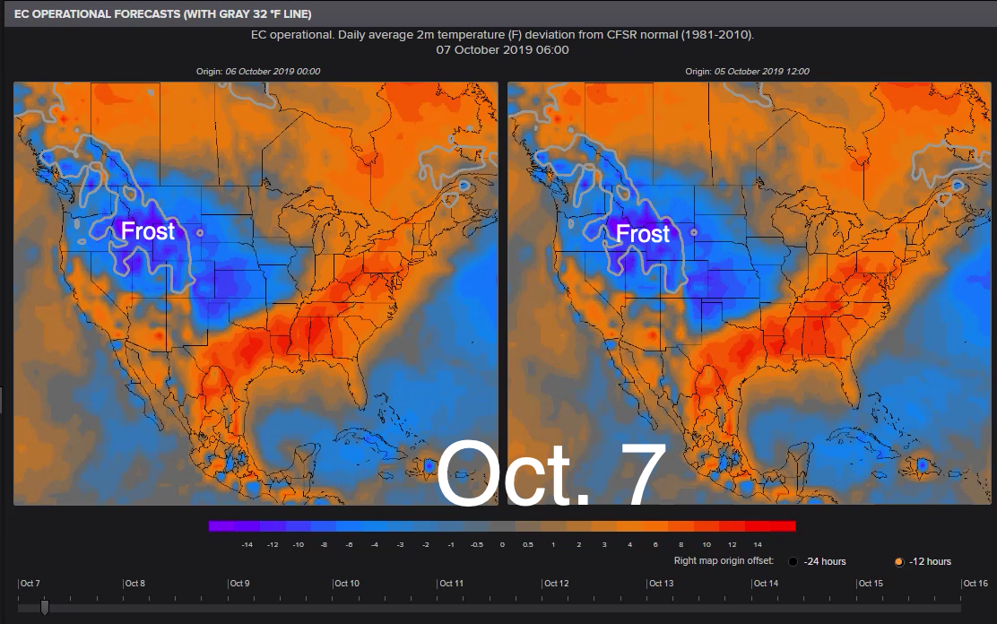
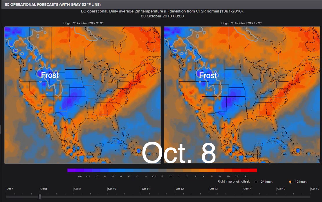
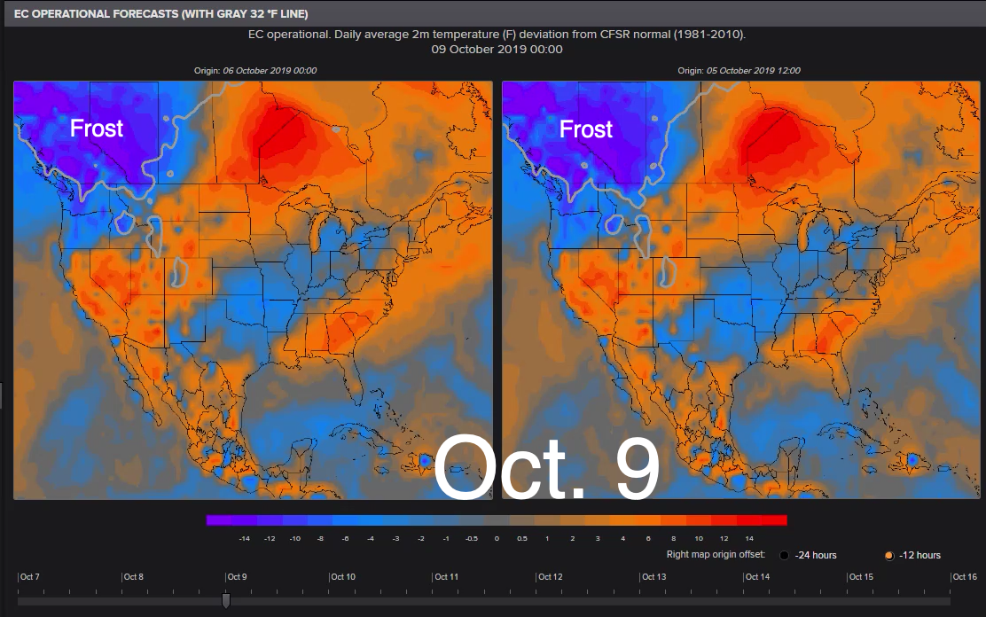
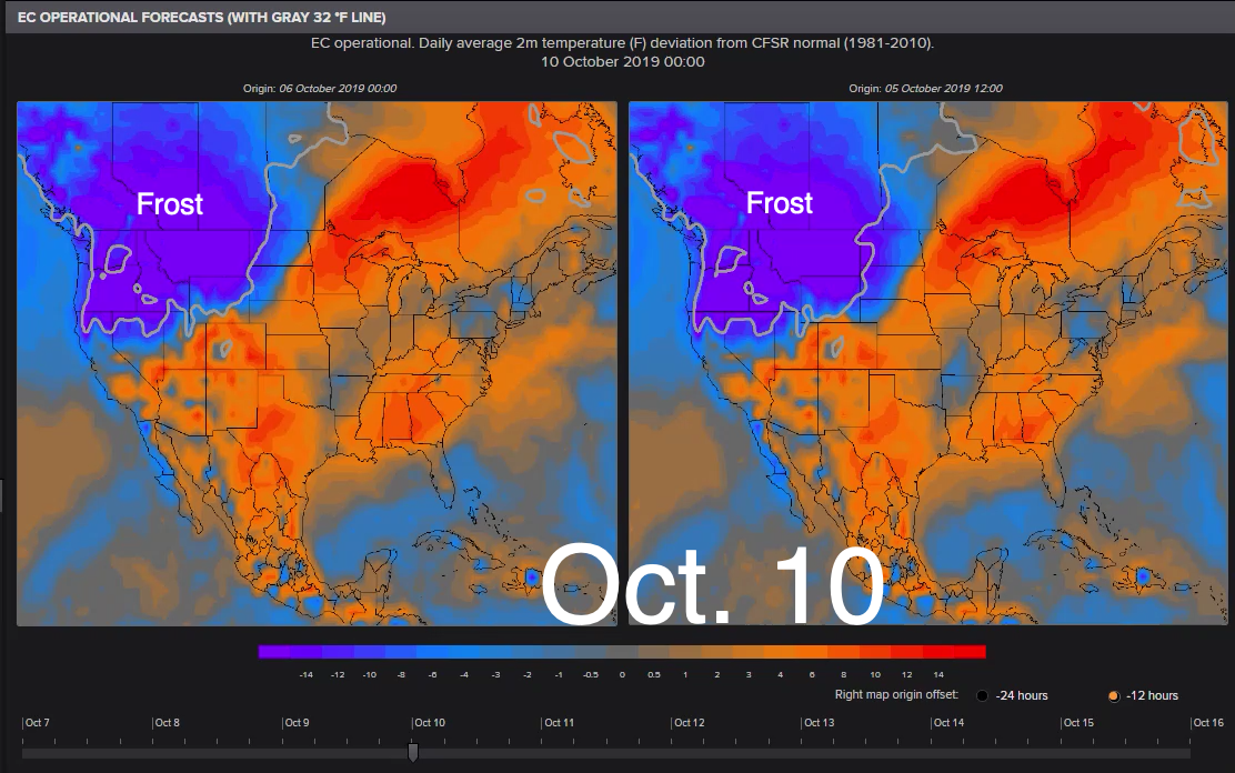
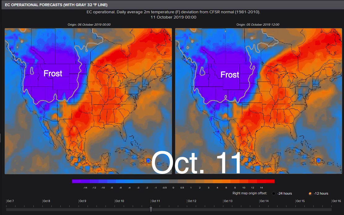
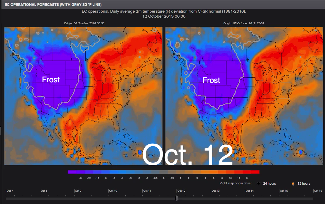
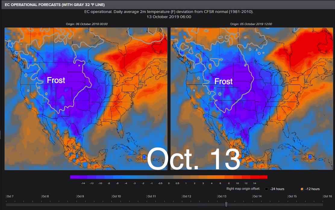
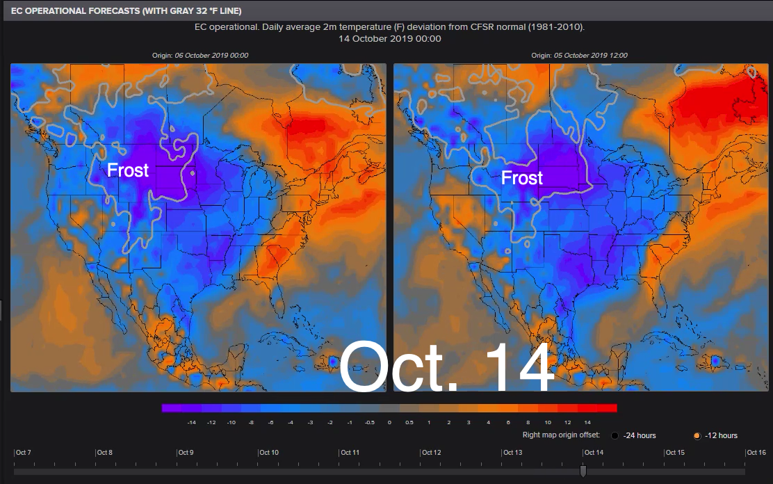
We are tracking frost and freeze potential US temperature weather maps this weekend that indicate a strong possibility frost-apocalypse is headed for the Pacific, Rocky Mountains, and Midwest regions over the next ten days. This could mean the end of the growing season for many agriculture producing states.
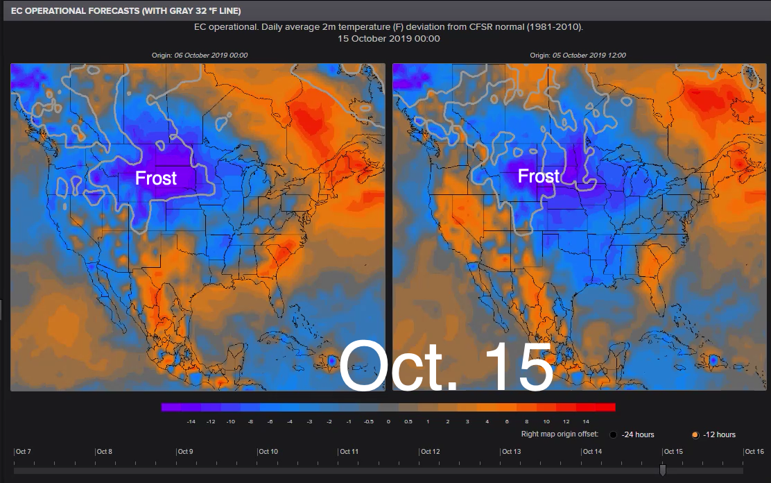
As shown in the EC Operational maps below, a 32°F contour line in the 5-10 day forecast indicates US frost risks could shift from the Northwest too much of the North Central states, which would officially mark the end of the growing season in those areas if confirmed by mid-month.
* * *
Andrei Evbuoma, a meteorologist for NOAA National Weather Service, provides further insight into the frost situation in the US, and what he thinks this could mean for grain prices.
Frost and freeze watches/warnings hoisted for portions of the north-central and Northeast U.S.; weather outlook turns colder across the northern and central U.S. raising risks for frost/freeze and thus upside potential of prices.
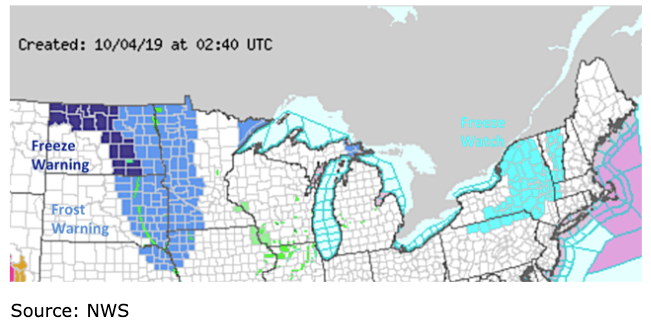
On the weather front, frost and freeze watches/warnings are in effect for much of North Dakota, eastern South Dakota, northeastern Nebraska, western Minnesota, northwestern Iowa, a large portion of Upstate New York and Vermont, extreme western Massachusetts, and extreme northern Pennsylvania. The frost and freeze warnings are in effect tonight through Friday morning. The freeze watch is in effect for late Friday night through early Saturday morning. The freeze and frost warnings over North Dakota and Minnesota cover a good portion of spring wheat. However, with much of the crop harvested, the impacts should be minimum. The northwestern portions of the corn and soybean belt will be impacted by the frost and freeze Thursday night/Friday morning. The freeze watch covers a very small portion of corn and soybeans that will not really be able to make any difference. Figure 5 below is an image depicting the areas under a freeze/frost watch or warning.
The weather pattern over the next 10 days or so can be described as progressive/changeable with bouts of both cool and warm air masses. The pattern will be driven by a couple of strong upper level troughs that will pivot around a pinwheeling parent upper low centered over the Arctic Circle near the Queen Elizabeth Islands. These upper level troughs will be associated with strong surface cold frontal boundaries that will spread across Canada and the Lower 48 bringing in intervals of unseasonably cool air. Upper level ridging will bring warm temperatures in between these upper level troughs.
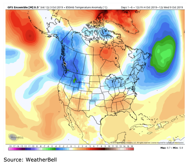
Over the next five days, the first upper level trough will eject out of the western U.S. eastward across the northern U.S. This will bring unseasonably cool air across the Northwest U.S. and Northern Rockies late week into the weekend, across the Plains and Midwest U.S. late weekend into early next week, and finally across the Midwest/Great Lakes into the Northeast U.S. early to mid next week. By early to mid next week, upper level ridging will build over the Northern Rockies and Plains bringing in warmer-than-normal temperatures before the next upper level trough quickly moves into western Canada from Alaska. Figure 6 below is a map from the 12z GFS ensemble depicting the 1-6 day (October 4-9) temperature pattern.
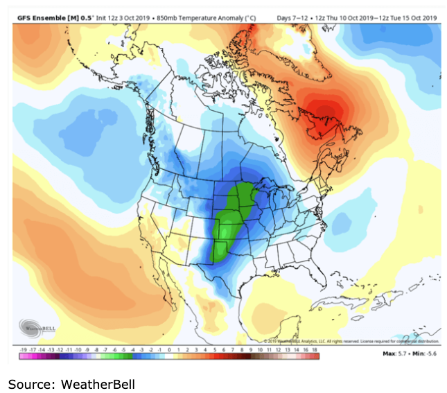
A second upper level trough with cold temperatures from Alaska will be oriented over western/central Canada in the beginning parts of the 6-11 day period. This upper level feature will quickly be moving inbound towards the Lower 48 meaning that the warm-up across the northern, central, and eastern U.S. will be brief. This second upper level trough will not only be stronger than the previous in strength, but will also be larger in size and will have more impact in bringing widespread cooler-than-normal temperatures across the Lower 48. Because this upper level weather feature is forecast to travel further south, unseasonably cool temperatures will encompass the central, southern, and eastern U.S. in the 6-11 day period. The reinforcing shot of cool air coming in behind this second trough will send temperatures as much as 20 degrees below normal across the Northern Rockies by Wednesday. This colder development amongst the forecast models has recently increased prospects of heating demand across the Lower 48. The GFS has been most consistent with this pattern. Figure 7 below is a map from the 12z GFS ensemble depicting the 7-12 day (October 10-15) temperature pattern.
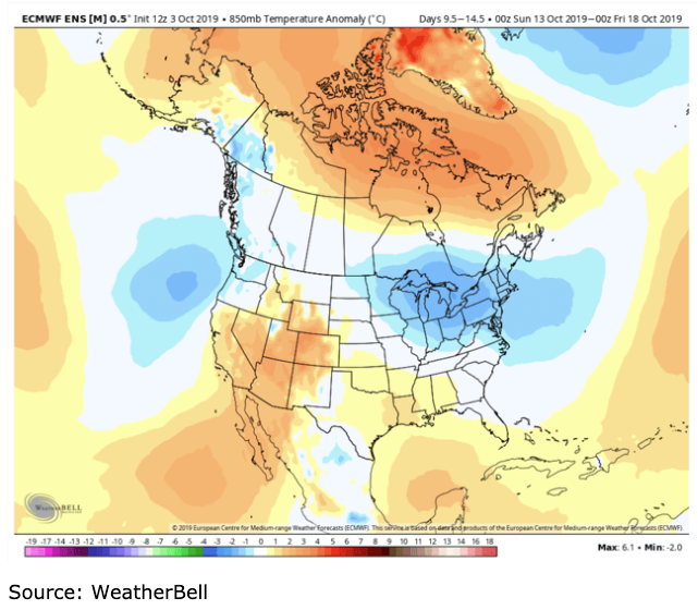
Temperatures look to be on the cooler side across the northern U.S. (especially the Great Lakes and Northeast U.S.) and warmer across the southern U.S. (especially the Southwest U.S.) in the 11-16 day time period with the pattern possibly remaining in a variable/changeable state. Figure 8 below is a map from the 12z ECMWF ensemble depicting the 10-15 day (October 12-17) temperature pattern.
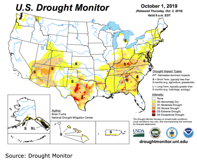
In terms of precipitation, the heat and dryness have set the stage for rapidly developing drought conditions across the eastern and southern U.S. including the southeastern Midwest. These areas have seen week/week increase in drought/dryness. Looking ahead, the pattern overall will transition into a drier pattern from the prior week. There will be chances for precipitation to come across the central U.S. in association with the upper level troughs/associated surface cold fronts. The first chance will come this upcoming weekend. The second chance will come mid to late next week. Figure 9 is a map from the U.S. Drought Monitor depicting areas of drought or abnormally dry conditions.
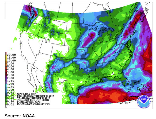
Figure 10 below is a map showing the seven-day accumulated precipitation forecast (Thursday morning to next Thursday morning) across the Lower 48.
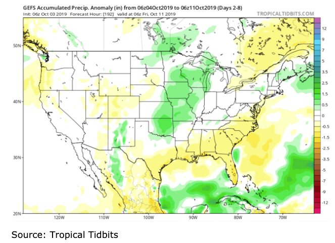
Figure 11 is a map from the 06z GEFS depicting a normal to drier-than-normal pattern across much of the country and a wetter-than-normal pattern over parts of the central U.S. in the 2-8 day time frame (October 4-11).
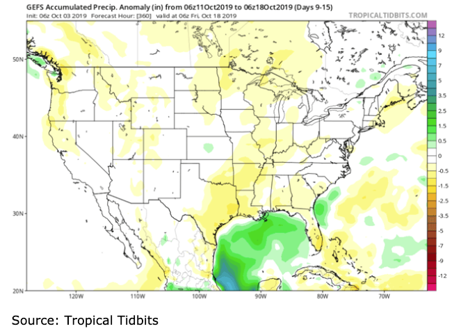
Figure 12 is a map from the 12z GEFS depicting a normal to drier-than-normal pattern across much of the country in the 9-15 day time frame (October 11-18).
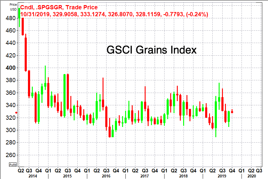
Evbuoma says the cold spell sweeping across agriculture producing states could be bullish for grain prices.
He says, "the weather outlook over the next couple of weeks has gotten colder, the risk of damage to crops not yet harvested have increased (particularly across the northern sections of the grain belt). This combined with the fact that China has been purchasing more soybeans means that upside potential is increasing."
https://www.zerohedge.com/commodities/frost-apocalypse-set-sweep-across-us-could-mark-end-growing-season

