

Vídeo de la fisura y las coladas de lava al oeste del cementerio de Las Manchas a las 12.30 hora canaria / Video of the fissure and lava flows to the west of the Las Manchas cemetery at 12.30 pm Canarian time https://t.co/7vFP6dcJW7

Custom Search
La Palma volcano eruption update: lava flow from yesterday's new fissure advances over new land towards the sea
Volcano DIscovery
12-5-21
17:16 PM | BY: T
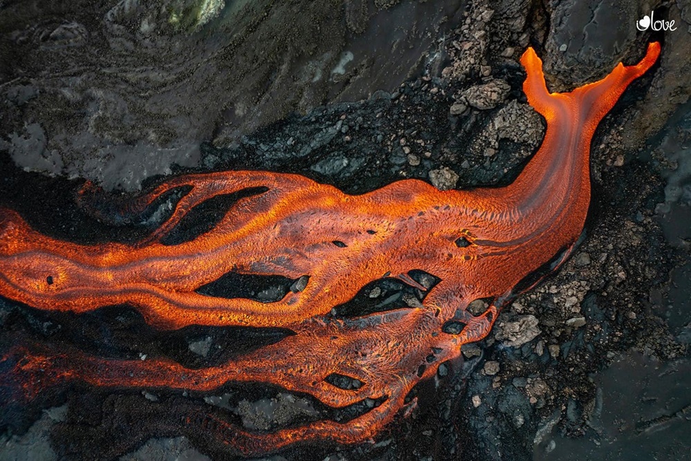
Aerial view of the lava flows on La Palma today or yesterday (image: El Time)
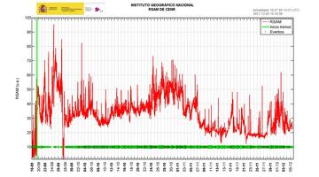
Volcanic tremor amplitude since start of eruption (image: IGN)
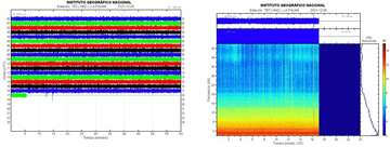
Current seismic signal TBT station (image: IGN)
Visible activity at the vents has been mostly low today. Most of the time, only steaming could be seen from the craters and only intermittent, weak pulses of strombolian activity and ash emissions only reaching a few hundred meters height. However, lava continues to flow from both the old vent areas (going mostly into the lava tube system) and the new fissure vents that had opened yesterday at 12.45 p.m. in an area 500 m west of Montaña Cogote south of Todoque, in the middle of a populated (but long-since evacuated) area.
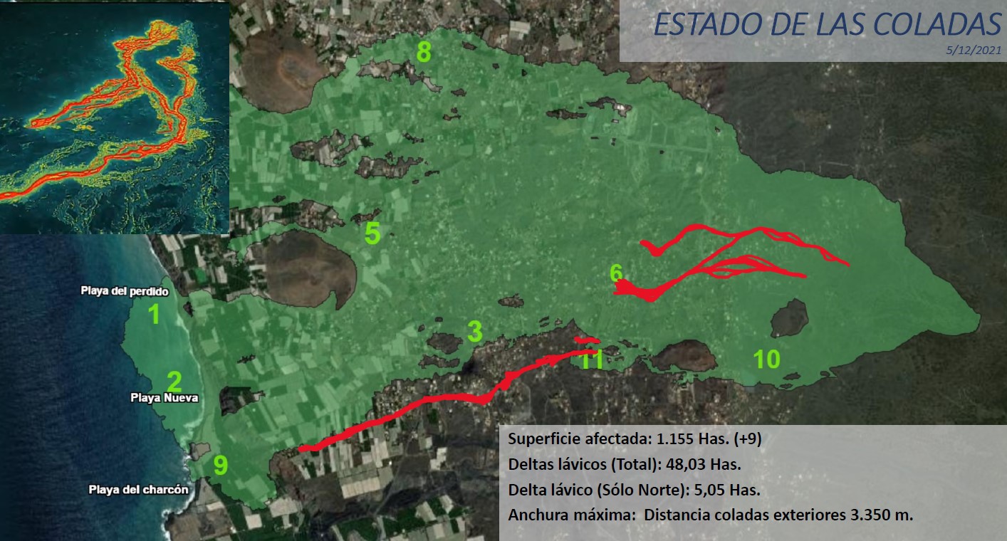
The new lava flow from this fissure traveled westwards along the southern margin of the existing flow field, covering new land and destroying additional buildings. Today, it continued to advance towards the coast and was near cliff in the Las Hoyas area this afternoon, but has not yet reached it.
The latest count of destroyed buildings rose to 2790 and the area now covered by lava flows increased by 9 hectares to now 1,155 hectares (1.55 square kilometers).
Seismic activity has been decreasing further. During the latest 24-hour reporting interval, the National Geographic Institute (IGN) detected only 35 quakes under the island, none of which was felt by the population at a wider scale. The quakes occurred under the central area of Cumbre Vieja in the same areas as during the whole time of the eruption.
33 of these earthquakes were located at depths of 9-17 km and only 3 at depths greater than 34 km. The amplitude of the volcanic tremor signal remains low and more stable than in previous days.
Ground deformation: The island's network of permanent monitoring stations shows a complete reversal of the elevation recorded on December 2 at station LP03, which is the closest to the eruptive vents. At the other stations, slight deflation possibly related to deep seismicity has stabilized.
Gas emissions:
Emission of sulfur dioxide (SO2) remains high, implying that there is still a log of magma available to erupt, although it has been on a decreasing trend. In the case of diffuse carbon dioxide (CO2) emissions, values have been stable, but still well above background levels or 5.3 times higher according to the latest scientific data.
Picture source: Se confirma la nueva fisura y la destrucción de un "amplio" número de viviendas (El Time)
- All news about: La Palma volcano
- Information about: La Palma volcano
Previous news
Sun, 5 Dec 2021, 17:01
During this evening's press conference, the latest map was published showing the current state of lava flows including the new ones from the past days and the fissure that opened yesterday shortly after noon. Read all
https://www.volcanodiscovery.com/la-palma/news/149660/La-Palma-volcano-eruption-update-lava-flow-from-yesterday-s-new-fissure-advances-over-new-land-towar.html