

UNNAMED SOURCE: 'USGS SUPPRESSING SUPER-VOLCANO ACTIVITY AT YELLOWSTONE UNDER WHITE HOUSE ORDERS/ RECENT EARTHQUAKES IN YELLOWSTONE'
Sheppard Ambellas
Unfortunately our time may be up–America may not exist soon as you’ve known it
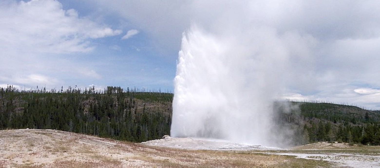
(INTELLIHUB) — In what may prove to be bad news for a one-thousand mile swath of the United States, the Yellowstone supervolcano may be on the brink of a massive explosion that would be categorized as an extinction level event (ELE).
In fact, recent reports suggest that ancient Helium4 gas has breached the surface layers of Yellowstone’s crust,escaping into the atmosphere. Now couple that with the recent and abrupt ground level rise in the park–and we may be looking at a spell for disaster.
I mean after all, as Michio Kaku, famous theoretical physicist, pointed out on a Jan. 2011 CNN newscast, “When it blows [Yellowstone] it could destroy the United States as we know it. [...] That’s what is making us nervous”
I don’t know about you but to me the thought of living in that region is horrifying, but what do I know, I live right near a massive volcano myself in Hawaii.
Later in the newscast the popular physicist points out how a 1000-mile ring of the U.S. would likely be destroyed if the supervolcano actually went. And as scary as that seems to some, we are actually quite overdue for the big one. In fact, the last Yellowstone eruption was thought to have happened around 630,000-years ago, meaning we are 30,000-years overdue for a total explosion.
Kaku also pointed out that, “Every single burp, murmur, of this gigantic supervolcano, including the rise above sea level, has to be watched very carefully”.
So basically, if you do the math for the disaster radius, the first 100-miles emanating out from ground zero would be completely wiped out. After that, ninety percent devastation would span out another 500 plus miles from ground zero, totaling a 1000-mile ring. Yikes!
Now this is where it get really scary, but there is no way I can vouch for the information, I simply can’t. According to a random individual who recently posted a video on YouTube, the United States Geological Survey (USGS) has likely been ordered by Washington to suppress information regarding recent seismic activity and gaseous releases in and around the Yellowstone region.
This information came directly from a connected individual, according to the video which also pointed out that they are “expecting the big one”. The random man’s source has not been revealed.
However, all of this matches up with actual data I was able to reference showing a rise of ground level in the park of more than 10 inches in the last week. So naturally this has me troubled as Michio Kaku as stated, “As the ground starts to rise, more and more earthquakes take place,that’s about all the warning we get”, answering a question regarding a forewarning.
Kaku finished with, “It will happen and it will destroy North America as we know it”.
VIEW VIDEO
*********************************
Recent Earthquakes in the Intermountain West
Yellowstone National Park Special Map
.gif)
Click on an earthquake on the above map (or in the list below) for more information.
Click here to go to index map || big earthquake list || all earthquakes list
Special maps: Yellowstone National Park || ANSS Intermountain West Region
Map need updating? Try reloading the page to your browser.
Maps are updated within about 5 minutes of an earthquake or once an hour.
Brown lines represent known hazardous faults or fault zones. White lines are roads.
Update time = Thu Mar 13 7:00:05 MDT 2014
Here are the earthquakes appearing on this map, most recent at top ...
 MAG    DATE    LOCAL-TIME  LAT     LON    DEPTH    LOCATION
        y/m/d     h:m:s     deg     deg     km
 1.8  2014/03/11 05:04:34 44.748N 110.788W  6.4   27 km (17 mi) ENE of  West Yellowstone, MT
 1.7  2014/03/11 03:20:36 44.833N 110.532W  6.7   27 km (17 mi) SSE of  Gardiner, MT
 2.2  2014/03/10 20:59:45 44.526N 110.870W  3.2   24 km (15 mi) SE  of  West Yellowstone, MT
 1.7  2014/03/10 19:53:20 44.801N 110.553W  4.8   29 km (18 mi) SSE of  Gardiner, MT
 0.9  2014/03/10 00:53:55 44.743N 110.798W  7.5   26 km (16 mi) ENE of  West Yellowstone, MT
 0.6  2014/03/10 00:36:13 44.755N 110.793W  9.9   27 km (17 mi) ENE of  West Yellowstone, MT
 1.7  2014/03/09 18:52:58 44.789N 110.761W  2.9   28 km (17 mi) S   of  Gardiner, MT
 1.8  2014/03/08 22:41:31 44.803N 110.537W  7.2   29 km (18 mi) SSE of  Gardiner, MT
 1.0  2014/03/08 22:37:05 44.825N 110.510W  5.8   28 km (18 mi) SE  of  Gardiner, MT
 0.8  2014/03/08 20:44:45 44.739N 110.782W  8.0   27 km (17 mi) ENE of  West Yellowstone, MT
 0.8  2014/03/08 14:47:28 44.732N 110.783W  2.2   27 km (17 mi) ENE of  West Yellowstone, MT
 0.2  2014/03/08 12:12:50 44.769N 111.172W  7.2   13 km ( 8 mi) NNW of  West Yellowstone, MT
 1.3  2014/03/08 11:41:30 44.820N 111.031W  7.8   19 km (12 mi) NNE of  West Yellowstone, MT
 1.7  2014/03/08 05:32:00 44.794N 110.638W  5.4   28 km (17 mi) SSE of  Gardiner, MT
 0.9  2014/03/07 02:57:41 44.745N 110.812W  5.0   25 km (16 mi) ENE of  West Yellowstone, MT
 1.1  2014/03/07 02:32:00 44.749N 110.806W  8.8   26 km (16 mi) ENE of  West Yellowstone, MT
 0.7  2014/03/06 12:36:22 44.729N 110.783W  2.1   27 km (17 mi) ENE of  West Yellowstone, MT
 1.5  2014/03/06 12:36:00 44.743N 110.776W  6.2   28 km (17 mi) ENE of  West Yellowstone, MT