

A map of all the underwater cables that connect the internet
Cables lying on the seafloor bring the internet to the world. They transmit 99 percent of international data, make transoceanic communication possible in an instant, and serve as a loose proxy for the international trade that connects advanced economies.
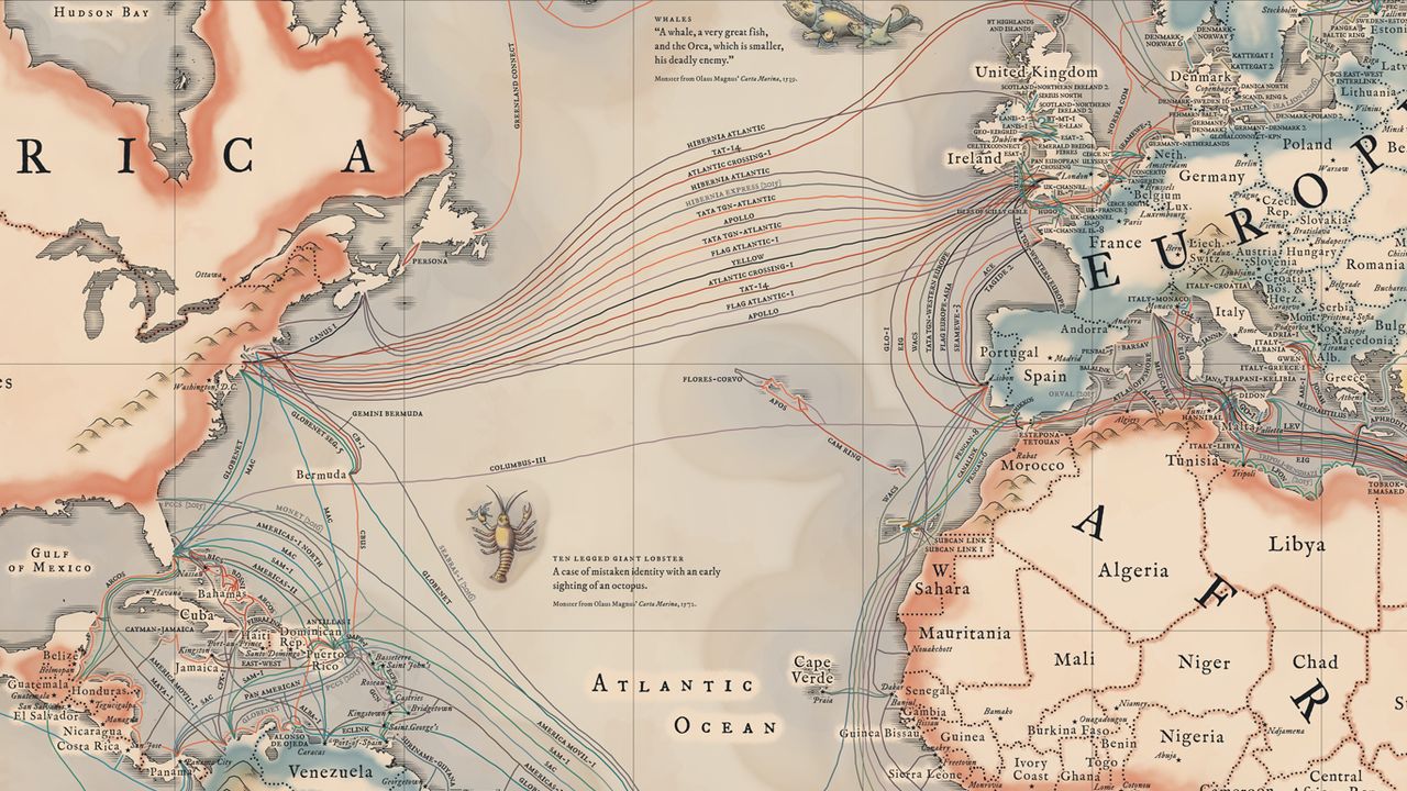
Their importance and proliferation inspired Telegeography to make this vintage-inspired map of the cables that connect the internet. It depicts the 299 cables that are active, under construction, or will be funded by the end of this year.
In addition to seeing the cables, you'll find information about "latency" at the bottom of the map (how long it takes for information to transmit) and "lit capacity" in the corners (which shows how much traffic a system can send, usually measured in terabytes). You can browse a full zoomable version here.
The cables are so widely used, as opposed to satellite transmission, because they're so reliable and fast: with high speeds and backup routes available, they rarely fail. And that means they've become a key part of the global economy and the way the world connects.
Take, for example, the below map, which lets you slide between a 1912 map of trade routes and Telegeography's map of submarine cables today. The economic interdependence has remained, but the methods and meaning have changed:
CONTINUE READING, VIEW ALL MAPS
http://www.vox.com/2015/3/13/8204655/submarine-cables-internet